This has been the second cloudiest winter in FL history, and one of the wettest in the dry season. We had some warm weather but only for a few days at a time.
I decided while I had the time this week I would post a map showing my entire trip including all my campspots.
The Red Numbers are my overnight stops starting in VA to FL, and are numbered from 1 to 18. The Red Lines are my actual routes. Click Here to see a larger map that can be zoomed-in.
This is my actual Trip Schedule.
I am finishing my second week at WP Franklin campground. I took some more short bike rides around the neighborhood streets.
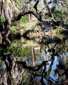
I decided to do another kayak trip from my campsite up Telegraph Creek on Wednesday. My plan was to paddle about as far as you can go and then have lunch sitting on a bench high above the river bank in the Bob Janes Nature Preserve. But hornets in the mud banks changed my mind, so I had lunch on a river sandbar instead, and took this picture.
There were several very large alligators on this section of the creek. They quickly lept into the water as I wound my way up and down the tiny river. It was a 7 mile round trip.
I left at 7am on Sunday morning to try to get a campsite at Lithia Springs County Park which is about a two hour drive north of here.
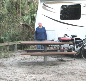
My hope is that some weekend campers will be leaving when I arrive. I got here at 9:30AM after some food shopping, I was 4th on the waiting list. I waited and rode my bike through campground to see how many were leaving, 11am is the checkout time. I lucked out a camper was leaving a day early from one of the riverside sites and by the time he left at 11 AM the other campers ahead of me got sites so I got Site 40, a site we have stayed in twice before.


Glad you're having fun.
Be safe, love you
Meg
I am glad you were able to get a site!! We leave tomorrow, I hope the weather is nicer than what we had in January!! Love you, see you soon Love, Pam
Oh Peggy!!!