2023-2024 Winter Trip

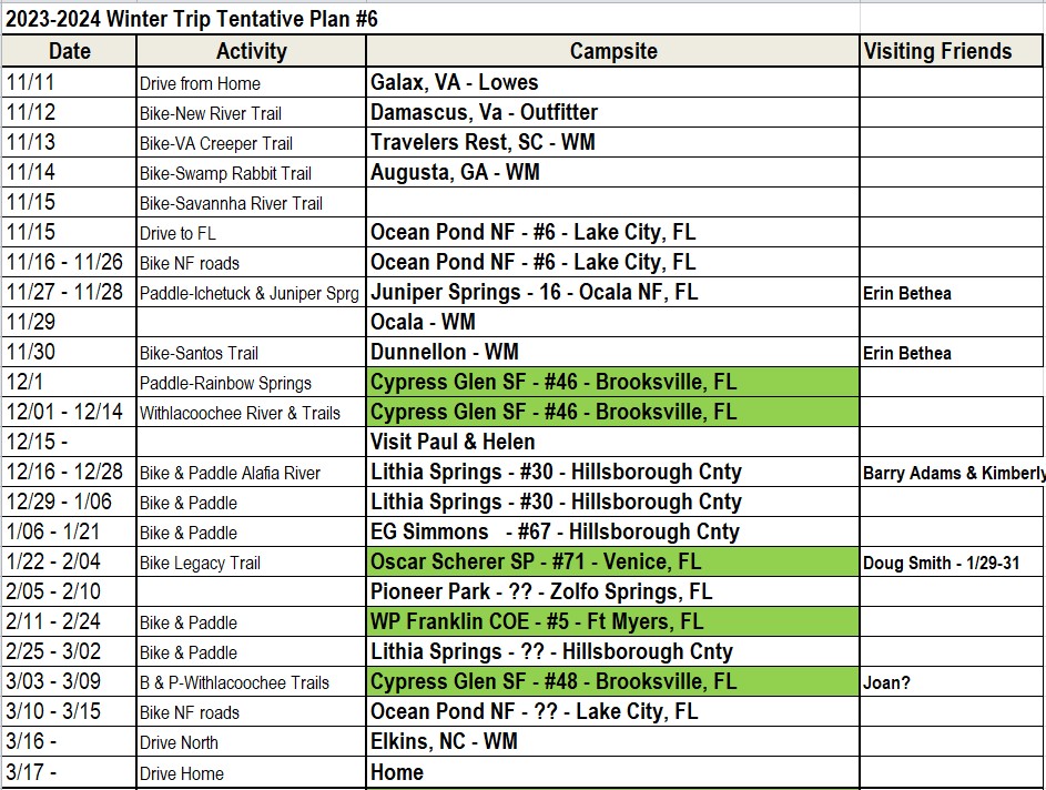
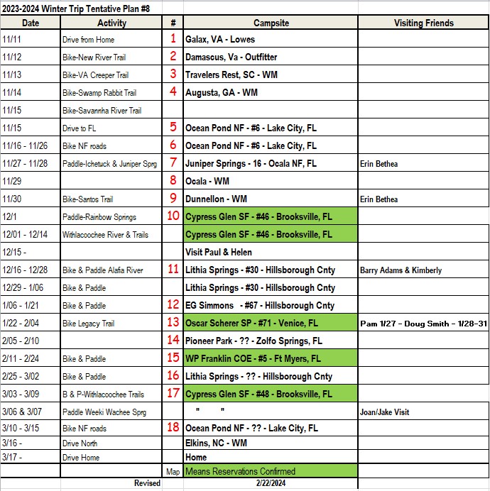
 I have a plan for my 2023-24 RV trip to Florida. I made reservations at the places I could and hope to be able to get a campsite at the campgrounds that do not take reservations by getting to most of them early on a Sunday morning. I do not drag a car so anyone that wants to share a campsite with me that has a car, van or small camper, I’m sure I can fit you on the campsite. Tents are also OK but no RV’s. Only one per site.

Updated 01/06/2024

I plan to do a lot of biking on the nice paved trails and I plan to kayak the rivers that I camp next to.

If you want to camp or visit me call me on my cell.

See next post for latest schedule

First days in Southern VA


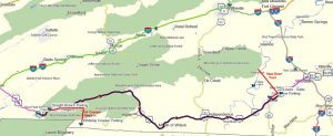
Map of VA mountains and the two bike trails
 

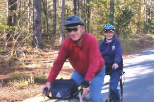
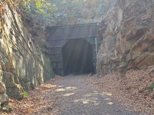
Here are some memories of Peggy 6 years ago when we first took our new tandem down the New River Trail.

The last time we did the VA Creeper Trail was 29 years ago on our mountain bikes. We started from the top at Whitetop Mountain and peddled down to near Damascus, Peggy waited for me to bike backup to the top and get the RV and continue south.


2023

I awoke early and was able to get on the road at 7AM for my 420 mile drive to Galax, VA. Being a Saturday and Veteren’s Day, the traffic was very light. Very few trucks even on the WV Turnpike. So with a stop for gas and a couple of other short stops I got to my destination Galax, VA at 2:30 PM,  It was a mostly sunny day but cool, 56

I decided to stay overnight in a Lowes parking lot. They had good wi-fi and it was very quiet, as opposed to the big Walmart across the road which was very busy & noisy. I had overnighted here before with Peggy at about the same time of year 6 years ago when we did the same trail. I decided to treat myself to a great Mexican dinner at Tlaquepaque Mexican Restaurant. It’s a really popular place with a huge menu of unique meals. I had the chicken chefs special which was basically a mexican stir fry dinner, it was huge and very good, I took my leftovers for a nice lunch tomorrow.

Chestnut Creek
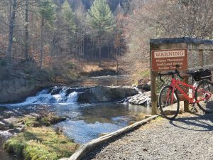
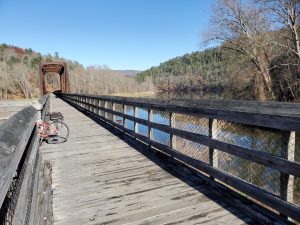
Galax is in the foothills of the mountains and has a nice gravel bike trail that goes from town and winds along Chestnut Creek for 11 mi to a bridge across the New River. It was cool morning 34o, so I waited to 10 am to do the New River State Park Trail.
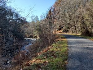
You can go upstream along the New River for 5.5 mi to Fries or downstream over 40 mi. I wanted to go downstream for about 3 mi to the Byllesby Dam but the trail was closed to replace some small bridges over the local creeks. I took my time and some pictures along the creek.
Chestnut Falls

When I got back to the RV, I had my great Mexican leftovers and relaxed for an hour before driving the very windy road to Damascus where I will camp for the night behind the shuttle service that I will use tomorrow to take me up to Whitetop Mountain, the start of the 17 mi VA Creeper Trail, where I will coast and pedal back to my RV.
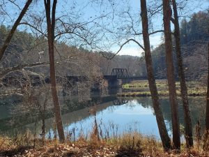
New River

Virginia Creeper Bike Trail


Whitetop Train Station Visitor Center


I camped behind Adventure Damascus, the outfitter that provided a shuttle up to Whitetop Mountan(3600′), I’m glad I decided not to attempt to bike in both directions like I did 29 years ago. The grade from Damascus (2200′) to Whitetop averages about 2% and the first 5 miles is more than 4%.

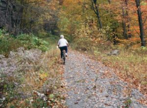
In fact for the entire trip I did not pedal more than 1 mile out the the total 17 miles. And the first 4 miles I had to be continually braking. It’s a narrow trail, mostly dirt, full of leaves. It’s really pretty but I was so busy making sure I didn’t crash, I’m sure I missed a lot. There was one other couple on the same shuttle and they took off and I never saw them again. I did pass two strong mountain bikers peddling uphill and two e-bikes going up as well. I can’t imagine dodging hundreds of bikers who do the trail when in season.

Even taking it easy and going slow I finished in 2 hours. I felt safer going faster when the trail got flatter.


Green Cove Station 

I guess I’m getting too old for all the maneuvering as you cross 30 bridges making your way down hill.

I don’t think I’ll be back here to bike again but it was a good experience.
 
The shuttle was at 9AM and it was a cool morning but I was dressed warmly. I got back and had lunch in my RV before driving 3 hours to a Traveler’s Rest, SC , north of Greenvile, SC. Traffic was heavy and slow south of Ashville and a big accident had the road closed but it was cleared before I got there.
 
I found a quiet spot with no cars to spend the night at a Walmart.
 
If you want to know more about the trail and area watch Mary Jo Monte’s from Ohio Video.


Tomorrow’s plan is to bike the paved Swamp Rabbit Trail to Greenville’s Falls Park and back. It’s starting to get warmer, high 60’s but clouding up.

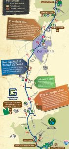
Swamp Rabbit Trail – Greenville, SC


Section of trail I rode – 21 mi round trip

Monday afternoon I got to the Walmart in Travelers Rest, SC. This section of trail is North of Greenville. 


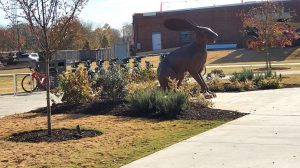
I started at Gateway Park about a mile from the Walmart, the parking lot had plenty of room for my RV and I biked to Reedy River Falls in downtown Greenville.

I loved this trail, very smooth wide asphalt with gentle hills. There are mileage markers every 1/2 mi, so it’s hard to get lost.

There are many places along the way for food or drink, but this is also a very scenic trail. I took lots of pictures. There were a lot of people making use of the trail, walking, jogging and biking, but it was far from crowded. It was a nice suuny cool day, temps started in 50’s and got to the mid 60’s by lunch time.

I was going to bike another section on Wednesday but it looks like some rain may be coming into the area. So after my bike ride I left for Augusta, Ga at 12:30pm and got to my Walmart stop at 3:30pm. Traffic was a little heavier but no delays.

Filled up on gas at Sam’s club for only $2.50/gal. I’ve gone 800 miles so far.

So after biking the Savananah River on Wednesday, depending on the weather forecast, I may head to Florida.

I can’t believe this small town has put so much money into a bike trail. It’s the best I’ve seen in any city, large or small.


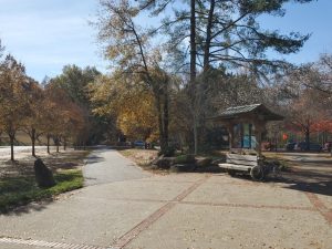
Trail & Kiosk near a parking lot

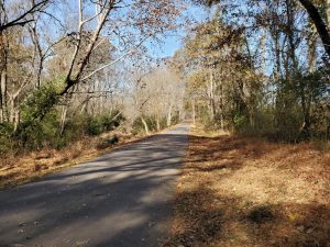
Typical Trail Section

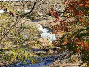
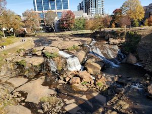
Reedy Falls from the trail

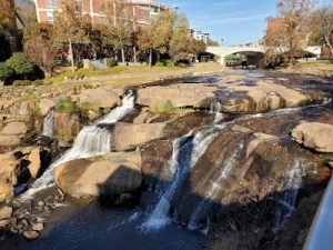
Reedy Falls from long bridge over the river
The Falls are right in the middle of their downtown

Augusta’s Savannah River Trails

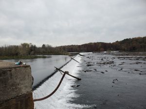
Savannah Diversion Dam

 I’ve done this trail that runs between the river and the canal several times with Peggy.

To see a map of the canal and nearby trails: Download a map of Augusta’s Trails

For the first 5 miles the trail is dirt and runs between the river and the canal. It may be muddy & have deep puddles after a rain.

Then the other paved trails split off, I took the 3.5 mi River Level Trail which goes to downtown Augusta and has views of the beautiful homes across the river. I did a 16 mi round trip and was on the road to FL by 11AM.

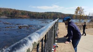
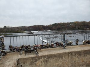
Peggy’s Love Lock
Here is today’s view
View of the homes across the river
I normally would have stayed for 2 days and biked the other trails as well but they were forecasting an afternoon rain and rain on Thursday as well.

So I got on the road by 11am for the 285 mile rainy drive to FL and stayed in my first campground of the trip in Osceola NF, Ocean Pond Campground. They don’t take reservations here and only have about 16 campsites with electric power and water. Because it was mid-week before the start of Thanksgiving week I was fortunate that they had 6 empty sites when I arrived just before twilight. I got the same campsite I had last March.
 
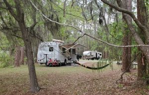
Site 6

So Thursday will finally be a rest day for me, it’s cloudy with a chance of rain but temps in the low 70’s. Finally I’ll be able to grill myself some Salmon & Zucchini.

Ocean Pond Campground – Thanksgiving Week

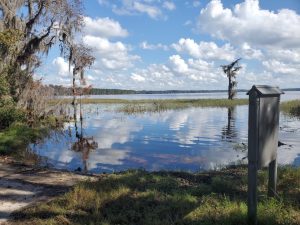
Ocean Pond Campground is in the Osceola National Forest in Northern FL. See my last blog about why I left early to secure a campsite for Thanksgiving week. The campground totally filled late Friday and I wonder if I would have got a site if I waited until Sunday morning as I originally planned.

We did get almost an inch of rain while I rested, but it was warm and sunny with temps. in the mid-70’s on Saturday morning. 

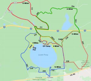
This map I made shows the options of different NF roads you can use to take a nice bike ride. So today I decided to do the 14 mile loop that goes east to Olustee Battlefield, site of a civil war battle. 

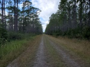
Forest Roads – No traffic and easy to bike on

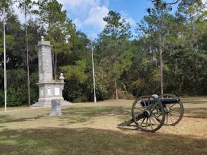
They have a small museum with some artifacts, and a few canon and a small monument.


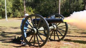
I swear I saw Peggy’s ghost actually firing one of the canons or maybe it was just an a halucination. 🙂
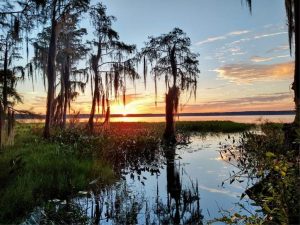
Nice Sunset from my campsite

Ocean Pond – Thanksgiving

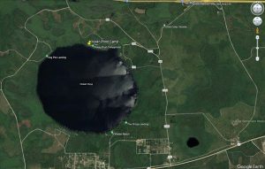
Aerial View of Ocean Pond Area
It’s been a warm week in Northern Florida, the highs have been in the mid-70’s and lows about 60’s.

I got here ahead of my plan late Wednesday (11/15) since there was rain forecast up in SC & GA. 

In past years it was difficult to get a campsite here during Thanksgiving week, but I don’t know if the pandemic in 2020 & 2021 changed campers plans because this park was closed at that time. 

There were lots of sites available with Electric & Water when I arrived, but the entire park filled up last weekend. However by Monday 11/20 the park again had lots of available sites and did not fill until Wednesday afternoon. 

The lake doesn’t offer much for me to want to take down my kayak and paddle, since although the area is scenic there are motorboats with fisherman that zip around the lake and it is no fun if it is windy. So in all the years we have been coming here I never attempted to paddle. I did find that the no traffic forest roads were ideal to bike on, but be sure to wear something bright during hunting season.

View from Hog Pen to my campsite


View from Olustee Beach to my campsite


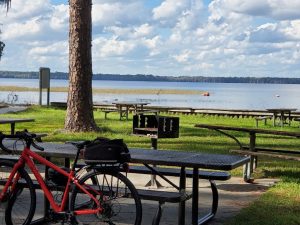
I took my second bike ride, a 14 mi ride on the sandy forest roads, around the lake and stopped at Hog Pen Campground and had lunch at Olustee Beach along the way. 

A cold front came in on Monday night and we had had a little rain on Tuesday while I waited for a FedEx envelope to arrive from my bank. It never came, and even with calls and promises to deliver, it never arrived on Wednesday either. 
 
It turned very cool on Thanksgiving Day morning, about 48o. But it was supposed to warm back to 60o  with sunny skies. I decided to take another 13 mi bike ride, this time to the northwest of the lake. About 2/3 was on paved roads but I never saw even one car. No one else even takes their bike out of the campground.
 
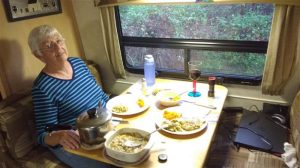
Missing Peggy’s Turkey Dinner
on Thanksgiving 8 years ago

I decided I would stay here for 3 more nights and drive over to Lake City to buy some groceries and then spend Sunday night at a Walmart. Then on Monday, I can get an early start to drive to the nearby Ichetucknee Springs River take-out. It’s easy to paddle for 3 miles upstream to the spring source and then drift back.

Ichetucknee Springs on Monday

It started to rain on Sunday morning and I needed to go shopping and get some groceries, so rather than break camp and drive to Lake City and back, about a 40 mi round trip, I decided to just check out, shop and stay at a Lowes overnight. I could go out to eat for the price of my campsite and get an early start on Monday morning after a short 20 mi drive to the Ichetucknee Springs River. 

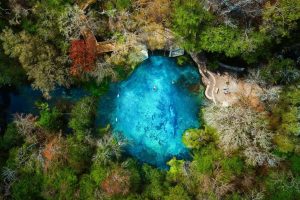
The striking clarity of the Ichetucknee River rates it as one of the best, if not the premier example of a spring-run stream in Florida. The park protects 3.5 miles of this cherished river, as well as its major springs and numerous seeps. The clear, cool spring water of the Ichetucknee River travels a couple of miles downstream before meeting the darker, tannic Santa Fe River. 

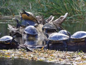
The current is fast and in the summer it is a favorite place for people to float on inner tubes. So for paddlers it is best to avoid the summer or warm weekends, then you might have the river to yourself. I have always started at the take-out and paddled the 3 miles up to the spring, then you can float back and enjoy the scenery, white-tailed deer, raccoons, river otters, wild turkeys, wood ducks, ibis and great blue herons can be seen from the river along with dozens of turtles on the fallen logs.

Sometime plans don’t exactly work out. On my drive over to Lake City I heard a loud thumping sound coming from a tire. Being a Sunday, not much I could do until Monday morning. I found my 9 year old tire was starting to delaminate, I needed to buy at least 2 tires in town. Sunday’s dinner plan didn’t work either, it was only 1/4 mi walk to the restaurant from my RV but it was raining so hard I decided to have some leftovers instead. Luckily I found a nice tire store right across from the Walmart and they had enough tires in stock, so I decided to buy all 6 tires and be done with it. I was on the road to the Ichetucknee by 10 am. I was on the river after 11 am and paddled to the source of the spring. I did see 3 river otters, 2 curious deer watching me paddle by and hundreds of very tame turtles. None jumping in the water when you paddle by like on other rivers. I also saw more paddlers going downstream, at least 20 in 5 or 6 groups, than I have ever seen before. 
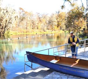
It was a sunny morning but after my big tire purchase I drove to the river and there was Peggy waiting for me to launch our canoe, I wish.

 
I got back to my RV by 1:30 pm after having lunch at the spring and was on the road to Juniper Springs in the Ocala National Forest where I checked in at 3:30pm, busy day.
 
Tomorrow’s plan is to meet up with Erin Bethea and her friend who are in the area paddling several rivers.


Juniper Springs and the Cross Florida Greenway

I made it over to Juniper Springs, once a favorite campground of mine. But over the years the Ocala National Forest Park has deteriorated, not the campsites, but the park itself. The best part of the park was this wooden walkway that paralleled the river and was a way to really see the river for park users who were not paddling. The park had volunteers that repaired the rotting boards and it was always walkable. Then some bonehead park administrator decided to hire a contractor to repair it. The cost was very high and they did a few hundred feet and decided it should be totally replaced but they did not have the money to do that so they just closed it. Then they hired a contractor to run the canoe concession, manage the campsites and run the boat shuttle. So they now charge you to put-in, and only do pickups at the take-out rather than letting you run a car shuttle and paddle at your own pace.

Well, you know me, I don’t follow rules, so we did our own shuttle since Erin & her friend Kathy both had cars, and Kathy’s rack could hold my kayak as well as theirs.
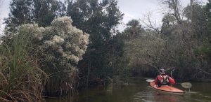
 
I picked a campsite that I knew had a secret trail to the river that was easier to use then the pay-for boat launch.
 
The river was great, no one else on it and a few fallen trees that we had to duck under. The fast current helped, we paddled the 7 mi river in 3 hours. But it was a very cool day, Low 50’s, so we saw no aligators and very few turtles.
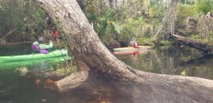
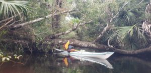
 
I may skip this river on any future FL trips, but don’t let my bad review stop you from trying the river at least one time.
 
I was cold and tired when I got back to camp and the temperature Wednesday morning was 35oF. I decided to skip paddling Silver Springs and just sleep-in, get some fuel and find a nice quiet campsite for the night. I pick a big Lowes store next to an Aldi’s.
 

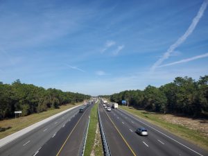
It was sunny and warmer on Thursday and just 3 mi from the Lowes was the Cross Florida Greenway, a paved trail that crosses over I-75. It has 4 underpasses for busy roads and only two road crossings on counry roads. It starts at Santos State Park and ends at FL-200. I did it the 16 mile trail from a Walmart on FL-200 to Santos and back. I peddled 32 1/2 miles in 3 hours and then headed to a Walmart in Dunellon for the night and hope to paddle on Friday with Erin & Kathy on the Rainbow Springs River.

I did think I saw someone who looked a lot like Peggy at the Land Bridge Crossing over I-75.