Reached my Most Southerly Destination

 After 2 weeks at WP Franklin my time was up but I didn’t have reservations at Collier Seminole State Park near Marco Island for two more days so I need to find something to do and places to camp. 

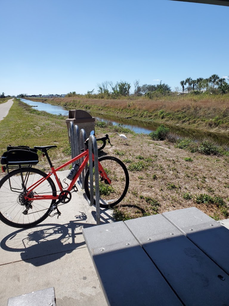
I left on Monday morning to bike on the John Yarbrough Linear Park Trail in Fort Myers which runs along the 10 mile canal.


It was very scenic and ran through mostly wooded areas. It crosses several busy highways where they route you to a nearby intersection crosswalk with traffic lights. I started on the south end and biked the 6 mile trail from their new parking lot up to the Page Field Airport. 

I had lunch there and watched all the private planes land. Near where I began there was Aldi’s, Walmart, Lowes & Home Depot for shopping, it was a very busy area. I chose the Home Depot to camp for the night.

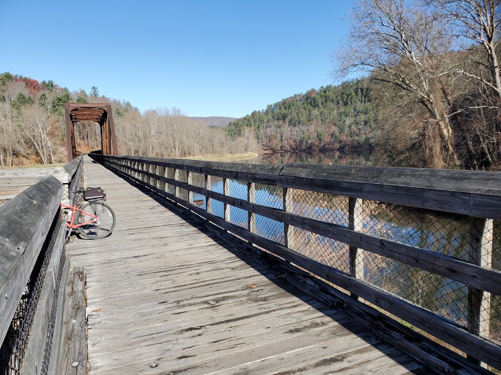
Haircut and my missing bridge
that fell out on my  birthday.

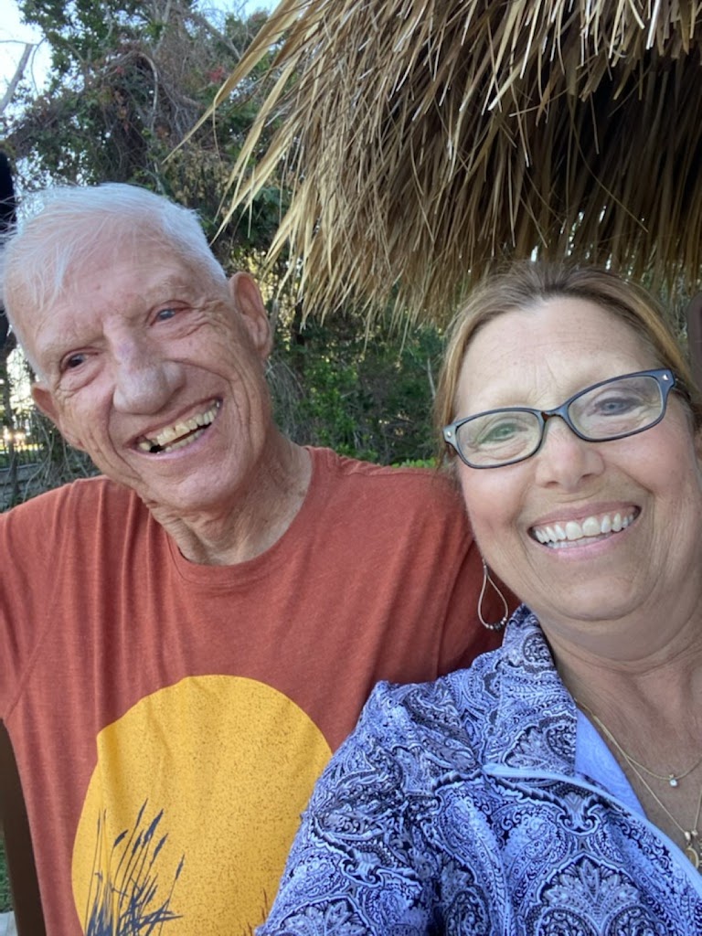
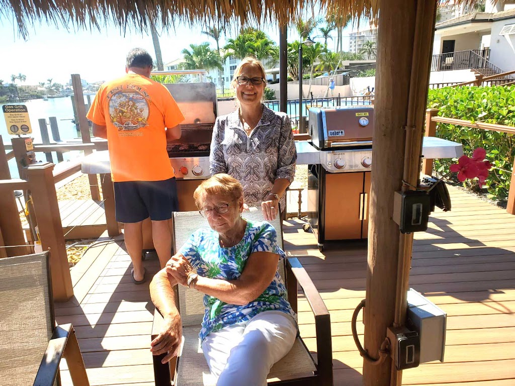
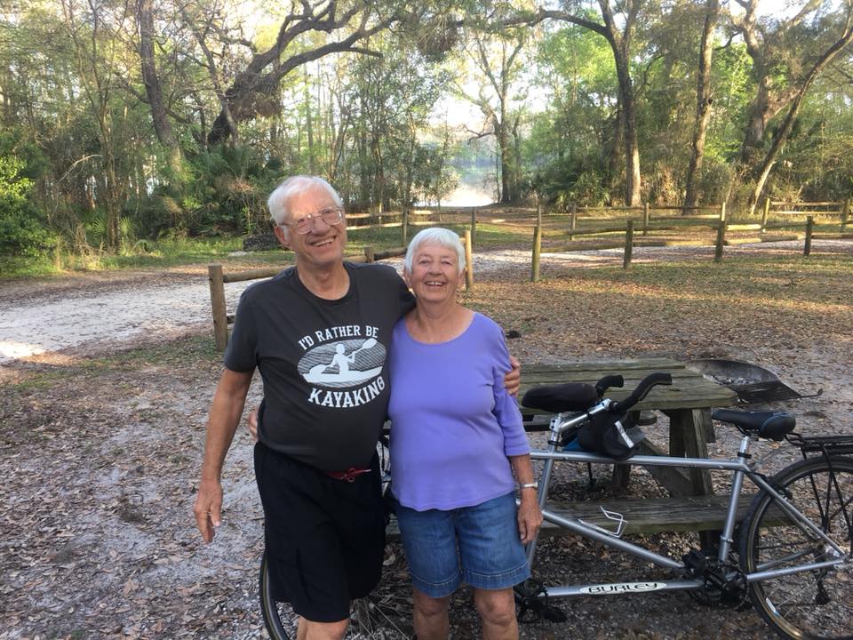
On Tuesday, Pat & Tom invited me to spend the day with them at his mother Rita’s condo in Naples. Since there was no place for an RV to park there, I parked at a nearby Sam’s Club. I had the morning to go get a haircut, my first of the trip. I was starting to look like a homeless person and felt I should look good visiting all my friends.

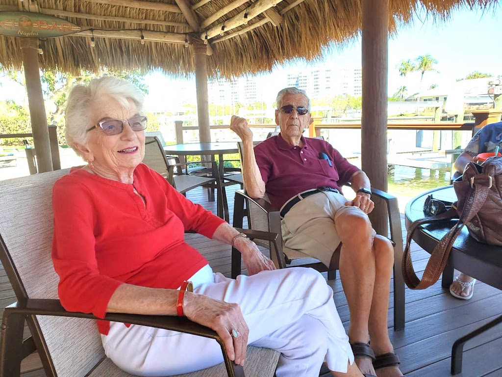
Before Tom picked me up. I called Joe & Sue Sivo since they had a condo next door to Rita. I was happy to find out that they were there and could stop over for a visit as well, They recently moved from Sheffield Lake to Chapel Hill, NC. They just got down to their condo in Naples in January.

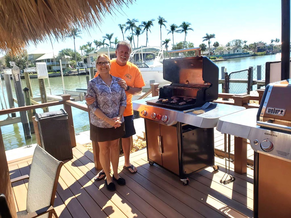
Tom & Pat put on a nice lunch and I also met Tom’s sister and brother in-law. I had a great time talking about old times and enjoying all their company. 


I realized that it would be dark in an hour so Tom drove me back to my RV and I headed to my overnight camp spot at a Cracker Barrel Restaurant near Marco Island. There were plenty of RV parking spots and I had a nice roast beef dinner. 

I left about 7 AM and headed to Collier Seminole State Park only 20 minutes away.


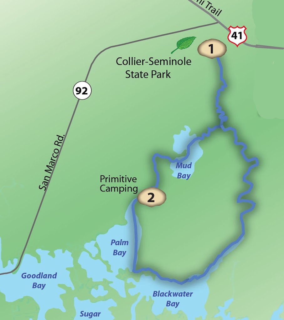
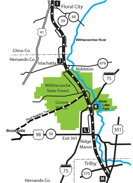
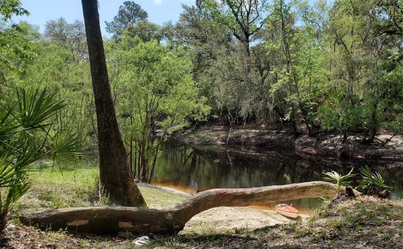
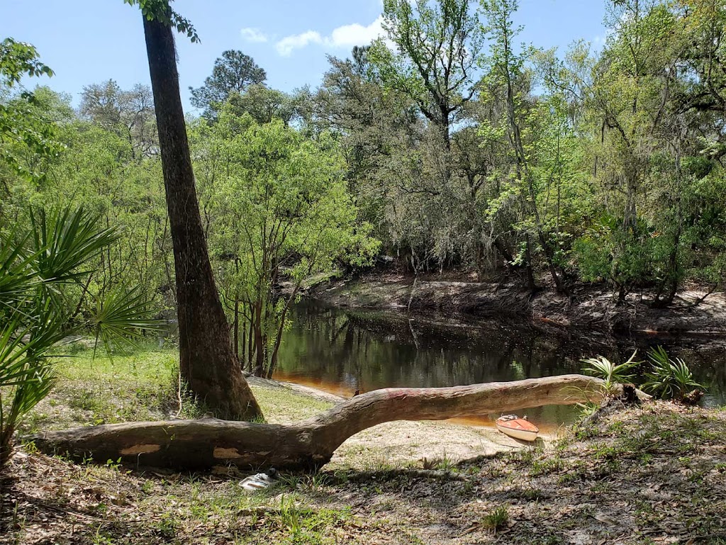
I snuck in the park before it opened at 8 am since the check-in time for my reserved campsite was not until 3 PM but I needed something to do today and it would be easy to drive the RV to the boat launch and unload my kayak there since it is more than a mile to the campsite. I was able to be on my adventure at 9 AM. The paddling trip must be done at near high tide to be able to get through Mud Bay. This is the link to the nearby Tide Chart. The tide takes 1-2 hours to fill Mud Bay.

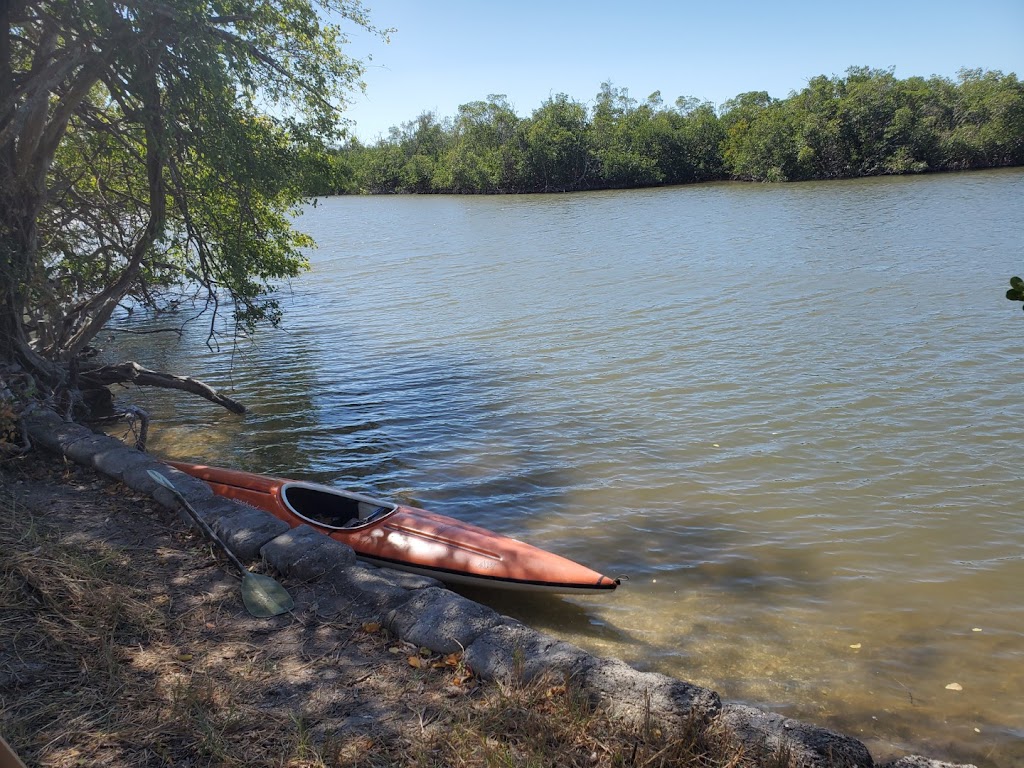
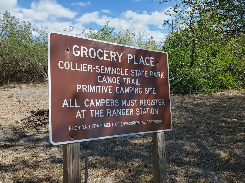
There are channel markers all the way to Blackwater Bay.  The park says “The adventurous paddler can follow the Blackwater River out to the Gulf to explore the islands, or continue on to Mud Bay and then back to the Blackwater River and the boat launch”.  After paddling up the Blackwater River, there was a strong current with the tide flowing against me all the way to the bay. I was able to find my way through the hundreds of small islands and eventually found the place called they called Grocery Place where I stopped for lunch at 12 noon.


 I was sure glad I had my GPS with me, trying to navigate through those small islands with no channel markers would have been impossible. There were some fishermen in small boats that I came across but I asked two if they knew if I was going the right way to Mud Bay, they had no idea.

Mud Bay had enough water if you were careful to avoid the shallow areas but I had a hard time finding the river I was looking for to get back out of the bay. But I finally found it and was back to the start after paddling 14 miles in 5 hours. 

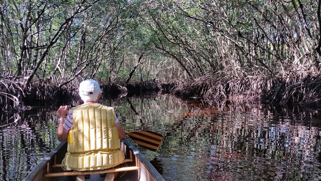
In 2017, I paddled here with Peggy and we paddled out the Blackwater River to the bay and back, that was a 12 mile trip. I liked that I was able to navigate the entire route this time by checking the tide charts, later in the week the tide may have come too late in the day.

Now I just need to figure out what next adventure will be.

I Left Collier Seminole, now back to EG Simmons County Park


Map shows the extent of all my rides

After my long kayak trip that I mentioned in my last blog, it was time for some more bicycling. The Blackwater River was really the only place you could paddle in the park, so there was no need to take the kayak off my RV.

In 5 days I biked over 75 miles, trying out every park trail and the nearby wilderness roads in the Picayune Strand State Forest

 I did some of the roads multiple times. You could take a state park hiking trail and then access the abandoned paved roads in the state forest. To get from the park to the nearby hiking trails required a 3/4 mi sprint down the bike lane on the Tamiami Trail. Going Northwest there was a wide bike trail to another hiking trail and beyond to a housing development and a huge tomato farm.

Actually, I first discovered this area in 1994 right after the forest took over the land from the developer. They still hadn’t blocked all the roads into the area. You could boondock along the canals for free. After that, they cut off all automotive access to the area and stopped all camping.


This is what Miller Rd looks like, I took a break and sat on a big rock for lunch.

This state forest wilderness was purchased 30 years ago from a scam developer that tried to sell the mostly underwater lots to suckers up north. He put in a few roads and canals and that messed up the environment for water reaching the Everglades. It also messed up the environment for all the wild animals that lived here like Deer, Bears, Panther, Alligators and all sorts of birds. I saw deer & alligators and some wood storks, but the only picture I got was of the two alligators in a tiny park pond along the hiking trail.

However, this week, I’ve seen a lot of heavy equipment working around some of the roads and some power lines being installed. Maybe they will eventually allow some camping in a few places, gosh they have 75,000 acres, it would still be a wilderness.

In all my biking in this area I never passed another biker, Even though every camper seems to bring their bikes, very few ride them out of the campground.

I have no camping reservations for the next 5 days but hope I can get a campsite at either Lithia Springs or EG Simmons County Parks that I stayed in 2 months ago on my way south.

I checked the Alafia River water level and found that because of the drought the river was low and was not paddleable so there was no use of trying for a campsite at Lithia Springs.

I left at 8:30 am on Wednesday morning and headed for EG Simmons County Park on Tampa Bay. Since traffic was light in the morning I stayed on I-75 all the way and I got there at 11:30 am. Of course it was full with 6 names already on the waiting list for campers leaving today. I decided to wait and when the last site was assigned they said I could stay in a non-power site and that I would be first on the waiting list on Thursday. That will save me going to a nearby Walmart and driving back at 7 am.

While I was getting set-up I turned on my water pump and found that it had quit working. I called a nearby mobile RV repair and they said they could replace it for $400. What the F$$$?  Too much. I ordered a new pump from Amazon for only $80 and it should get here by Friday. I found that the non-power site still had a water connection so no pump was no problem, but I need to replace the pump for when I’m on the road. 

I found it not that hard to remove.  When my new pump comes on Friday it should not be too hard to install. It will give me something to do and keep busy.

UPDATE – Pump arrived Friday at 12:30pm, all installed and everything back together at 1:30pm. All working again.

It has been so hot here. Every day in February except two were in the 80’s. I need to paddle or bike early in the day while it’s still cool. I will be here through the weekend and then will head back to Silver Lake near Brooksville on the Withlacoochee River and 46 mile long paved bike trail.


Back to Cypress Glen campground on Silver Lake


I miss peddling and paddling with Peggy, this was her favorite campground to do both.

I got site #45 this year, two sites away from the site in this picture but close to Silver Lake. They paved the campground road since this picture, making it easy to bike to the paved Withlacoochee State Bike Trail (46 mi).

This area is a beautiful State Forest but the two main reasons we come here is for the paddling and the biking. 

Canoeing & Kayaking

We are only 100 yards from launching our canoe into a wide spot on the Withlacoochee River called Silver Lake. The river is slow so you can paddle upstream or downstream from our campsite and then paddle back so no vehicle shuttle is necessary. However if you do want to set up a shuttle you can drive down the road about 10 miles to a wayside park in Nobleton, drop off your vehicle and use the paved bike trail to bike back to the campground. You can also paddle upstream and try the narrow winding Little Withlacoochee if the water level is high enough or continue upstream on the main river past the Crooked River Campground as far as you like and then  paddle back to camp.
I got here on a Monday afternoon and was able to bike three times and paddle twice this week, I did a 6 mi rt kayak trip upstream from my campsite and then I did the 9 mile paddle downstream around Hog Island and back. I left early to avoid the forecasted high winds, when I was returning across Silver Lake the winds were really picking up but luckily they were behind me on the lake.

I saw lots of large birds near Hog Island; Ibis, Egrets, Heron and a few big Wood Storks . I saw a few small gators including a tiny baby gator. It was unusual, but I also saw a small snake swimming across the river.

Biking

You can bike 1-1/4 miles on the nice paved roads through the campground and intersect the 46 mile long paved Withlacoochee State Trail  at  mile marker 9 (K on map). 


From there you have 3 options. Pedal south to Trilby the start of the trail (21 mi RT), I did that on Tuesday.

You can go north about 1 mile to the paved Good Neighbor Trail (This link has some nice pictures) The trail goes west to the City of Brooksville (26 mi RT). I did that on Thursday. This section has some small hills and a few curves but is still in the shade most of the way. It ends at a city park and train museum.


On Sunday I took the route north to Floral City (31 mi RT). It was another hot day so I left before 9 am. Also there were a lot less bikers on this popular trail at that time. By mid-day you will see dozens. The map I posted shows these options, the white dots are one mile markers.


I usually see a few Gopher Tortoises near the trails. They dig huge holes in the sandy soil and after a few days they dig another new home The old hole becomes a home for other  animals that can’t dig such nice holes for their homes. The gopher tortoise is about as charming as a tortoise can get. Originating 60 million years ago, it’s one of the oldest living species on the planet and the only native North American tortoise species east of the Mississippi River.
This campground has some other wildlife beside squirrels. We once saw some Coyotes passing by and if you hear leaves rustling at night, its probably an Armadillo.
 I think February set records for High temperatures in central FL this year. There were only 2 days when the daily highs went below the 80o‘s for the whole month of February including the first week of March. And next week the forecast is still for highs in the 80o‘s, maybe when I leave here and head to northern FL it will cool off. Up there they are forecasting highs only in the 70o‘s and lows around 50o.

My plans are to stay here for one more week and leave early next Sunday (3/12) and look for a campsite at Ocean Pond campground in the Osceola National Forest off I-10 in northern FL, west of Jacksonville. 

Finished another week at Silver Lake and now at Ocean Pond


During my last week at Silver Lake I biked twice and paddled twice.

I paddled upstream for 3 miles and stopped at this nice beach for lunch and then headed back to camp. I don’t know if this is private property or not but it doesn’t look like a good place to park.


I kayaked upstream twice this week. I didn’t see any gators or birds like my downstream paddle and you also pass some homes along the way. But you will see a lot of turtles sunning on the logs.

In all my bike rides to Brooksville over the past 4 years on the paved 10 mi long Good Neighbor Trail, we usually stopped at the train museum and park at the end of the trail. There is not much else around there. 
I was wondering where all the stores in Brooksville were. I looked on the map and saw that if I just biked through a few quiet neighborhood streets I could make my way over to all the stores and restaurants and even a Walmart. It did make it a 30 mi long bike ride.

I got a nice early start from Cypress Glen campground at sunrise, 7:30AM on Sunday morning (3/12). I stopped at a Walmart and Aldi’s near Starke and got to Ocean Pond campground in Osceola National Forest near Lake City, FL by 11:15 am. They do not take reservations and have a 14 day camping limit. 

I was hoping to get one of the 19 sites with electrical & water hookups and lucked out, someone had just pulled out of #6.  It’s a nice big site with lots of shade and trees to tie up my hammock.


The power sites are normally full everyday but from Sunday to Thursday if you get here by 10-11 AM you can usually get a site. All the campsites are always full on the weekends. There are three different camps at Ocean Pond, the second one has about 20 water hookup only sites and the last one is in a nice woods but no water hookups, it is better for tent campers. They raised the price this year so the sites with senior discounts are only $20, $10 and $6. The extra $10 for the power sites makes the non-power sites more popular than in the past.


On Sunday night I finally got the first heavy rain on this whole trip. A cold front also brought a tornado watch but it never got that windy but it didn’t stop raining until noon so I took the time to write this week’s blog.


Ocean Pond is a 2 mi diameter round lake and if it were not windy you could do a nice 6 mile paddle along the shore line. I have never paddled here. I have biked all the forest roads in the area shown on the above map. The best ride is the one over to Olustee Battlefield State Park, it is the site of the biggest civil war battle in FL. There are a couple more rustic campgrounds in the area, Hog Pen and Cobb.

I don’t have a date yet when  I plan to leave and head for home. It mostly depends on the weather. I have usually made it home from here in 2-1/2 days.

After 100 days, I’m back home

 As I described in my last blog I was at Ocean Pond Campground for the past 6 days. No kayaking but I biked the four big loops shown on the map posted on my last blog. So this year I ended up biking 780 miles on my new gravel bike and paddling 110 miles in my kayak. I got lots of cardiac rehab and gained a couple of pounds, hopefully all muscle.

I always watch the weather before I commit to the long drive home. I was ready to come home after my 100 days on the road and it looked like spring-like weather was coming to Cleveland starting with the first day of spring on Monday. But the forecast for Saturday in FL was lots rain all day where I was camped. I was surprised when I awoke that it was still dry but rain was coming in an hour. I quickly broke camp and was on my way by 7:45 AM. I did drive through a little of very light rain in southern GA. Traffic was light and I made really good time. I entered SC at 1 pm which was way too soon to stop for the night.  So I pushed on through Columbia & Charlotte which was slow but still made it to a nice quiet Walmart in Elkin, NC by 5:30 PM.

When I looked at Sunday’s forecast I saw that it was snowing back home but would stop in the morning and there was some snow in the mountains of WV. It was a sunny but a cold day. When I reached southern WV there were dark clouds and snow flakes, but no travel problems.  I made it home at 3 PM, Westlake was the only place I saw any snow on the ground for my entire trip. 

My daughter’s Joan and Pam came over and helped me unpack the RV. It was so fast it would have taken a few days with me unloading by myself, I really appreciated their thoughtfulness.

 I have a plan for my 2023-24 RV trip to Florida. I made reservations at the places I could and hope to be able to get a campsite in the campgrounds that do not take reservations by getting to most of them early on a Sunday morning. I do not drag a car so anyone that wants to share a campsite with me that has a car, van or small camper, I’m sure I can fit you on the campsite. Tents are also OK but no RV’s. Only one per site.

Updated – 11/01/23

If you want to camp or visit me call me on my cell. I plan to do a lot of biking on the nice paved trails and I plan to kayak the rivers that I camp next to.

Ready for Florida

2023-2024 Winter Trip

 I have a plan for my 2023-24 RV trip to Florida. I made reservations at the places I could and hope to be able to get a campsite at the campgrounds that do not take reservations by getting to most of them early on a Sunday morning. I do not drag a car so anyone that wants to share a campsite with me that has a car, van or small camper, I’m sure I can fit you on the campsite. Tents are also OK but no RV’s. Only one per site.

Updated 01/06/2024

I plan to do a lot of biking on the nice paved trails and I plan to kayak the rivers that I camp next to.

If you want to camp or visit me call me on my cell.

See next post for latest schedule

Cleveland Script Signs

I bought a new bike jacket and padded under shorts for all my expected bike riding when I head south. So I decided to take a short 14 mile ride around Cleveland to see the different views by the Cleveland Script signs near downtown.

Edgewater

Shoreway Overlook

Near Sokolowski Overlook

Columbus Road

Rock Hall

First days in Southern VA


Map of VA mountains and the two bike trails
 

Here are some memories of Peggy 6 years ago when we first took our new tandem down the New River Trail.

The last time we did the VA Creeper Trail was 29 years ago on our mountain bikes. We started from the top at Whitetop Mountain and peddled down to near Damascus, Peggy waited for me to bike backup to the top and get the RV and continue south.


2023

I awoke early and was able to get on the road at 7AM for my 420 mile drive to Galax, VA. Being a Saturday and Veteren’s Day, the traffic was very light. Very few trucks even on the WV Turnpike. So with a stop for gas and a couple of other short stops I got to my destination Galax, VA at 2:30 PM,  It was a mostly sunny day but cool, 56

I decided to stay overnight in a Lowes parking lot. They had good wi-fi and it was very quiet, as opposed to the big Walmart across the road which was very busy & noisy. I had overnighted here before with Peggy at about the same time of year 6 years ago when we did the same trail. I decided to treat myself to a great Mexican dinner at Tlaquepaque Mexican Restaurant. It’s a really popular place with a huge menu of unique meals. I had the chicken chefs special which was basically a mexican stir fry dinner, it was huge and very good, I took my leftovers for a nice lunch tomorrow.

Chestnut Creek
Galax is in the foothills of the mountains and has a nice gravel bike trail that goes from town and winds along Chestnut Creek for 11 mi to a bridge across the New River. It was cool morning 34o, so I waited to 10 am to do the New River State Park Trail.
You can go upstream along the New River for 5.5 mi to Fries or downstream over 40 mi. I wanted to go downstream for about 3 mi to the Byllesby Dam but the trail was closed to replace some small bridges over the local creeks. I took my time and some pictures along the creek.
Chestnut Falls

When I got back to the RV, I had my great Mexican leftovers and relaxed for an hour before driving the very windy road to Damascus where I will camp for the night behind the shuttle service that I will use tomorrow to take me up to Whitetop Mountain, the start of the 17 mi VA Creeper Trail, where I will coast and pedal back to my RV.
New River