Click any Chart to Go to USGS Site
For More Info
For More Info
Casselman River Info
Paddling Range - 2'-5'
Paddling Range - 2'-5'
Cheat Forks Info
Dry Fork Range - 700-7000 cfs


Dry Fork Range - 700-7000 cfs
Narrows Paddling Range - 450 - 8000 CFS
North Branch of Potomac Info
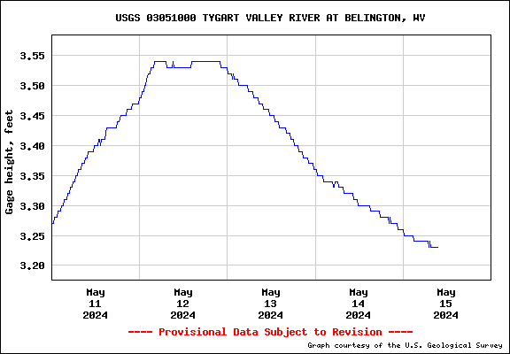

Tygart at Belington
Paddling Range - 3.5'-7'
Paddling Range - 3.5'-7'
Tygart at Philippi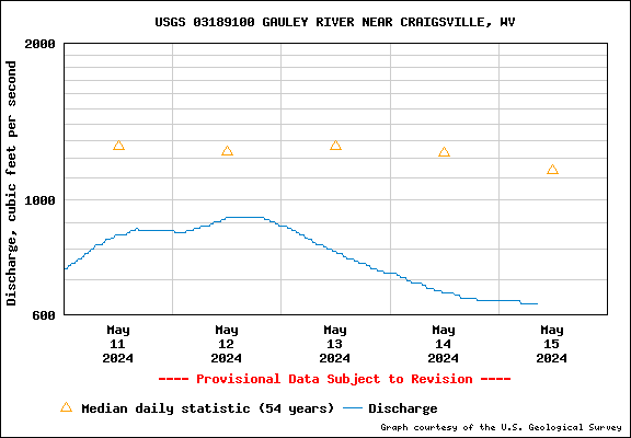
Paddling Range - 1500 cfs - 3000 cfs
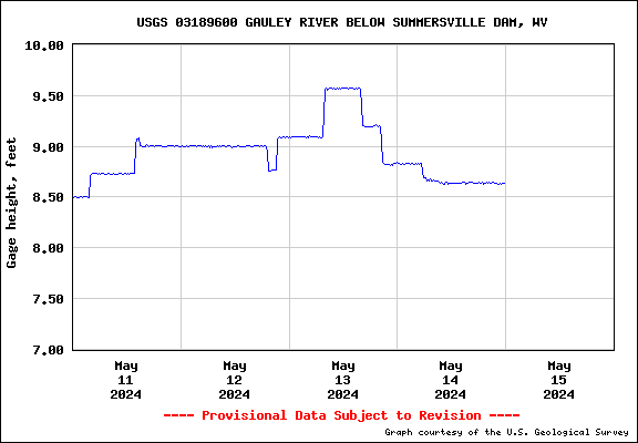
Gauley River at Craigsville
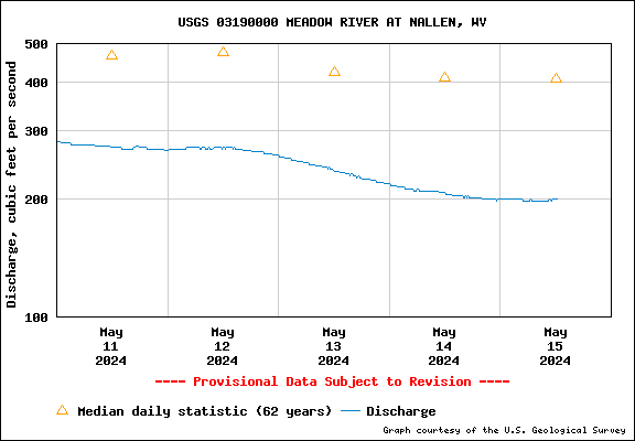
Meadow River at Nallen
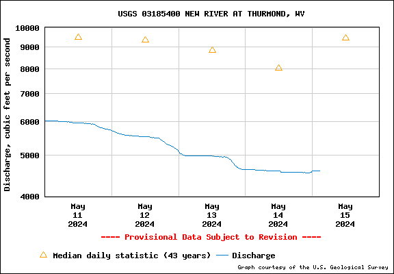
Need information/maps on the New River?
See this LINK
See this LINK
Click any Chart to Go to USGS Site
For More Info

For More Info
Blackwater River at Davis
Middle Fork at Audra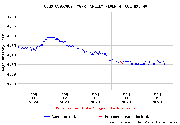
Tygart at Tygart Dam
Paddling Range - 3.2'-6'
Paddling Range - 3.7' - 4.7'
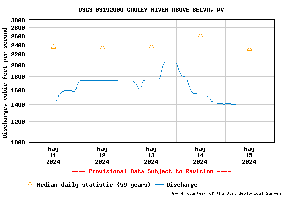
Gauley at Belva