Public Meeting for 2013 Dam Removals on the Cuyahoga River
January 14, 2013
by Dave Hill
Click here for Matt Muir's report on Cuyahoga Dam Removal (October, 2012).

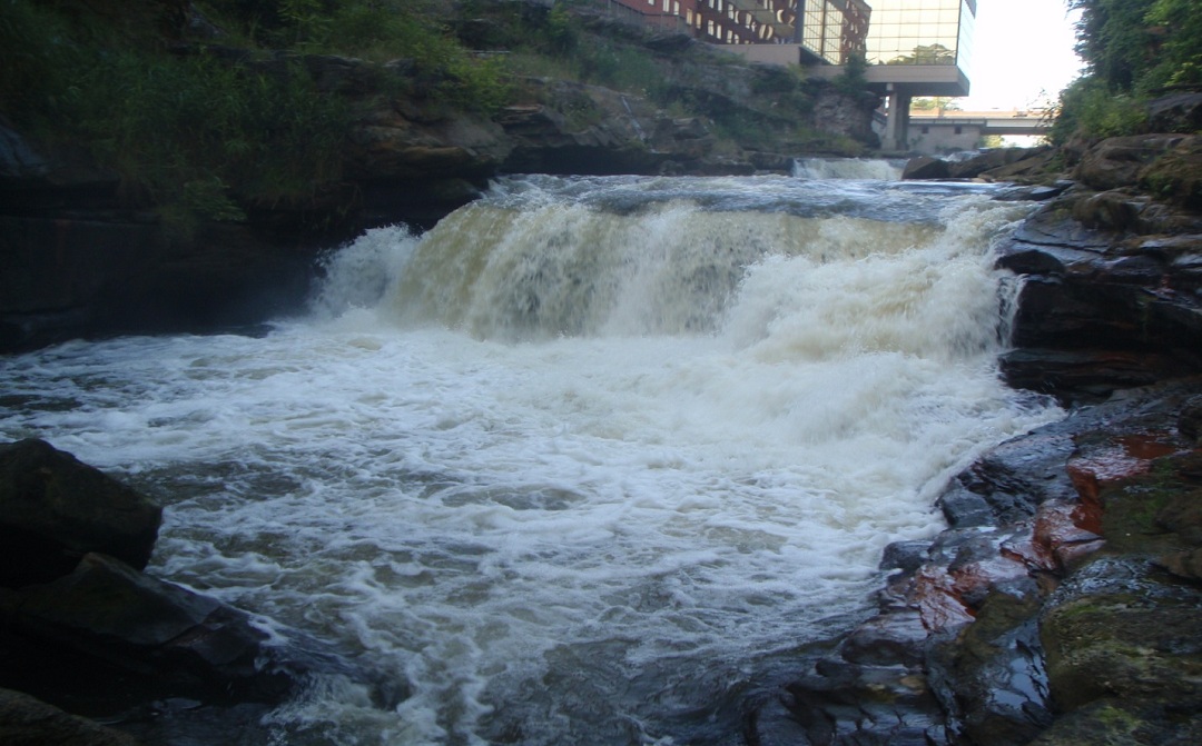
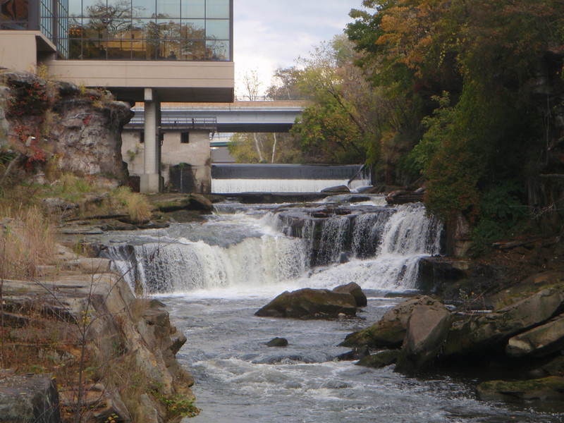
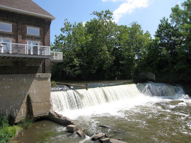
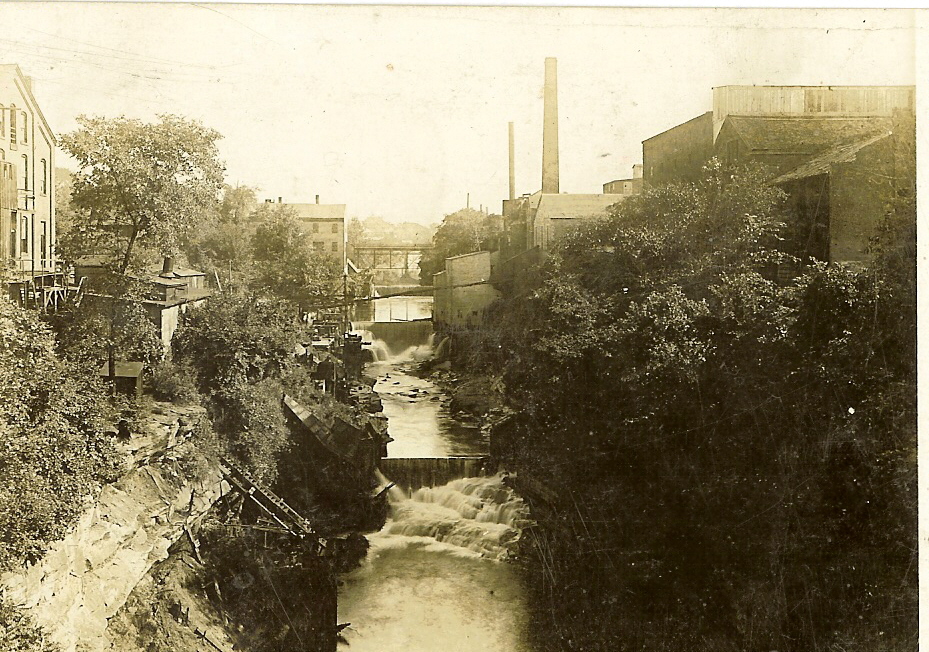
One question that I consistently hear from everyone is “what will the river look like when the dams come down?” Sometimes this same inquiry is posed in the question, “will we lose the waterfalls that are currently there?”

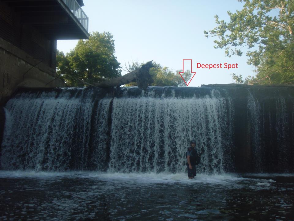
First off, the two downtown dams are NOT waterfalls. However dams are typically constructed ON TOP of waterfalls (or ledges) so that the total height of the drop is naturally increased (dam height + height of natural drop = total height).

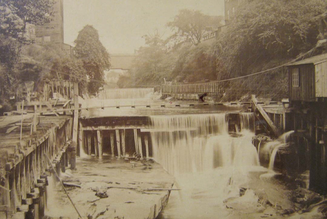
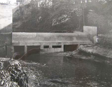
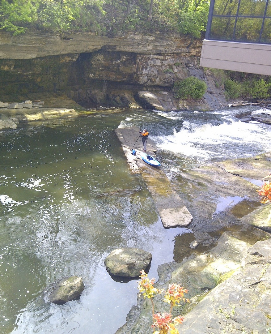
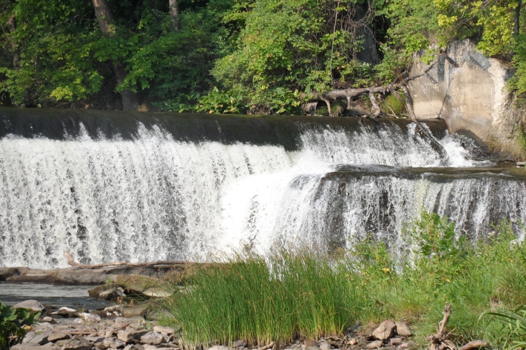
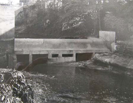
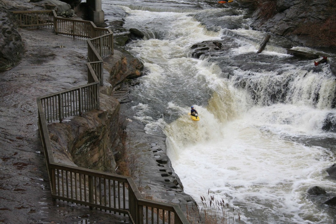
As outlined in the below photos, there were at least two other dams below the existing Sheraton Dam that confirm the above statements.


The Sheraton Dam is the small structure located behind the angled walkway (near the center) and the historic photo shows two large dams downstream of the current Sheraton Dam. This photo also shows these two dams being located ON TOP of a natural ledge (or waterfall).

The lower dam appears to be a structure about 3-4 feet tall constructed ON TOP of a natural ledge (waterfall) that is about 10 feet tall. The below photo shows this same location after the lower dam was removed where a waterfall is currently located. For reference, this is the last drop that can be observed from the deck near the pool of the Sheraton Suites.


The other dam that is no longer present is shown in the historic picture, above. This dam was located on a natural ledge of about 8 feet in height.


Now that this dam has been removed as shown in the below photo, it is obvious that a natural ledge (waterfall) is present.


So the next question is “Could these same scenarios exist for the two dams to be removed in 2013?” Considering that I have yet to find similar photos for the two remaining dams which confirm the proposed scenarios, we have to look at what data is available.

One fact which needs to be considered is that the geology of the immediate area where the river flows through downtown is relatively consistent. If one looks at the bedrock over which the river flows between Waterworks Park and High Bridge Glen Park, it is known as the Sharon Sandstone. This formation is a thick unit of sandstone with relatively strong cement holding the grains, and therefore is more resistant to erosional forces from the river. This resistance is characterized by the narrow stream channel and relatively straight course as the river passes through downtown. Within the Sharon Sandstone are layers/areas of less resistant material/cement which can erode more quickly and make up some of the undercut areas observed along the cliff walls in the river channel.

Another fact for consideration is that dams are located at specific points along the river which have natural features that will create a good location for dam construction. These river features can be a natural ledge as discussed earlier, or a natural constriction in the river to funnel the river energy, or both. Since at one time there were as many as 4 dams between the Route 8 overpass and the Prospect Street pedestrian bridge natural river features were present to entice so many dams to be constructed in a short section of river. Within 0.7 miles, the river drops over 60 feet!

Now as we look at the two dams scheduled for removal in 2013 and the previous discussion, we know the following information.
  1. Both dams are constructed on top of bedrock.
  2. Bedrock is exposed behind the curtain of water flowing over the LeFever Dam.
  3. Bedrock is exposed along the shore near both dams suggesting a constriction or ledge feature.
  4. Water depth immediately downstream of both dams is shallow.
The photo below shows a view looking upstream at the current Sheraton Dam, shortly after its completion of construction. This photo confirms #1 and #3 above. It is also known that the river is channeled toward the west (left side of photo) as evident by the exposed bedrock surface sloping toward the river and the location of the dam gates on the west side.


This next photo shows a small diversion dam (2-3 feet tall) that was constructed downstream of the Sheraton Dam. This structure was designed to direct water towards the east side in order to feed the aqueducts and provide water power needed for industries along the east side of the river. It is evident in this picture that bedrock is exposed along both sides of the diversion structure and the river is channelized and shallow (#3 and #4) immediately downstream of the structure (right of the person).


As we look at the current information for the LeFever Dam, we can make some similar conclusions. The below photo shows that an existing ledge is present along the east side (right) of the river and may extend under the LeFever Dam (#3 above).


While I do not have a photo of the bedrock exposed behind the water curtain (#2), the base of the LeFever Dam is a large flat surface of bedrock less than 2 feet below the water surface. As shown in the photo below, this was a concern for paddlers during the landing for the Bicentennial opening ceremony. It was observed that the water depth decreased toward the east (right side of photo) and confirms #1 and #4.


Predictions

So what does all this tell us about what the river will look like once the two dams come down? Well, as a geologist and a regular paddler of the project area, here are my predictions.

Upstream of LeFever Dam

Some paddlers have seen the BBC&M report (October 2008) and their presentation of data to the City of CF (Part 1 and Part 2). Based upon the report, some projections of river gradient were presented, and this BBC&M graph has been overlain on a Google Earth image (see below image). The report has good info, but I would rely more on the topographic data than their aerial water-level interpretations of the river.


Kasper, in his thesis presentation, constructed a bedrock surface map (Fig 47) in the report titled "An assessment of the LeFever Dam pool." His thesis report can be found here; the bathymetry map is presented below.


There may be rapids from Riverfront Park that will start near the stone RR bridge and increase slightly to the Route 8 bridge. There seems to be a drop below/near the Route 8 overpass, and a narrowing of the rock banks on each side just upstream of the bridge (pages 18-19 of the BCC&M report) could make this a tricky section in the river. At this point gradient and flow will increase to the LeFever Dam in what seems to be a channel along the west bank (river right [RR] side). I talked in detail with John Peck (Akron U.) on the above thesis and he confirmed that the area between Route 8 and LeFever Dam will be bedrock riverbed with boulders sporadically placed. This was based upon the probing that they completed for this study/thesis. It also makes sense from the geology of this river section: Erosion of massive sandstone takes more time and results in finer material being moved downstream as it rolls along the steep gradient of the bedrock surface. Only very large boulders remain (those that are not easily moved by the river) and the boulders may be more prevalent in the areas upstream of Riverfront Park where the river cross section may be wider with less gradient.

As shown in the below photo there is a natural rock ledge that is believed to extend all the way across the river and be the base of the dam construction. Page 17 of the BBC&M report seems to confirm this assumption. I’ve talked to an older paddler who had a mishap running the LeFever Dam a number of years ago. He washed behind the falls and stated there is a fairly large space behind the curtain of water. I have confirmed that the dam is constructed such that several vertical walls parallel to the river create these large spaces, and in some of them the bedrock is exposed.


Upstream of Sheraton Dam

The section between the dams is tougher to figure out. I have felt ledges with my paddle while probing during kayaking but the thalwart (center of the channel) is too deep to touch. There is some information presented in the BBC&M report (pages 15-17) that indicates the presence of a somewhat narrow channel between the Portage Trail overpass and the Sheraton Dam. Immediately downstream of the cement pylons by the Portage Trail overpass on RR side is a ledge that we use to launch boats. At lower flows (~200 cfs) this ledge is about 4-6 inches above the water line. This ledge may be part of the “feature” shown in the BBC&M report (page 15) near transect 10.38. Given the elevation drop of the Sheraton Dam (~12‘) over 1400 feet of river (base of LeFever Dam) there may one or two ledges in the main channel of this section.

The only historic photos I have seen of the Sheraton Dam (Mill Dam) construction are presented in Phase I History/Evaluation of two dams on the Cuyahoga River, by Hardlines Design Company (Aug 2011) for the City. The best photo in this report shows a view of the dam during its construction in 1914 from downstream and looking back upstream with limited water. This photo (shown below) indicates that the large rock on the RL side of the dam is actually the top of a rock ledge that the dam is built upon. This would imply that there is channeling along the RR side that is shown in the BBC&M report (page 15, Plate 8) near transect 10.23.


Summary

The bottom line is that the riverbed will consist of a bedrock surface over which the Cuyahoga River will flow very fast and create rapids through the project area. The nature of the Sharon Sandstone formation will include some layers that erode more easily than others and create small ledges or waterfalls. River features will be characterized by the amount of water flowing in the river and conditions will get more intense as river flow increases.

So while the dams will no longer be present, the waterfalls near the Sheraton Suites will remain as they are. My overall sense is that once the dams have been removed and the river finds its natural course of flow, the conditions will be similar to what is shown in the below photo and upstream of the paddler. I don’t think that there will be any large drops like the one he is going over, but the likelihood of several smaller ledges/waterfalls each ~4 feet or less in height is a good possibility.


Click here for Matt Muir's report on Cuyahoga Dam Removal (October, 2012).


This website is using DHTML Menu By Milonic JavaScript