Previous Day Map 2010 - Go to Mexico Trip Map 3
Previous Day Map 2011 - Go to Mexico Trip Map 4
Next Detailed Map - Go to Mexico Trip Map 5
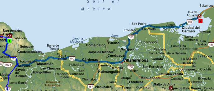
After we leave the Catemaco area we will head through Villahermosa, then North along the Bay of Campeche to Freedom Shores Campground on Isla de Aguada. Don't forget when you pass Frontera and cross into state of Campeche they may search for illegal items; Chicken, Pork, Eggs, Citrus fruit could all be confiscated
| City | City | Miles | Hours |
| Catemaco | Acayucan | 55 | 1:50 |
| Acayucan | Villahermosa | 140 | 3:20 |
| Villahermosa | Isla de Aguada | 135 | 3:50 |
| 330 | 9:00 |